|
Texas
Environmental Energy Group Inc.
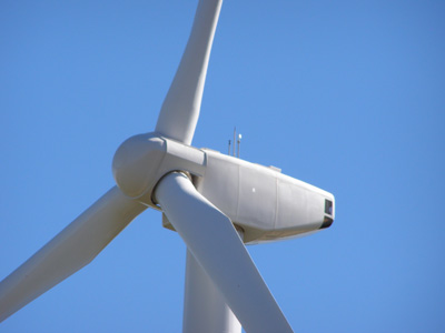
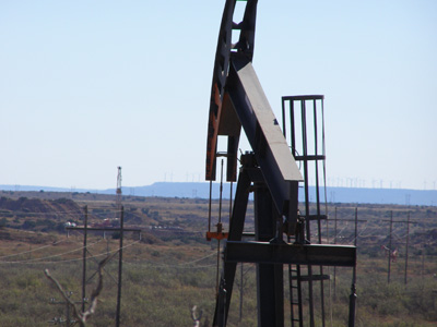
(This wind turbine produces enough electricity for over 300 homes in
Texas.)
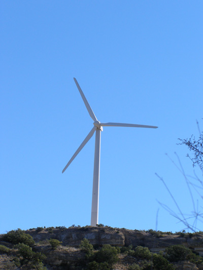
WIND POWER
Characterization of the Resource
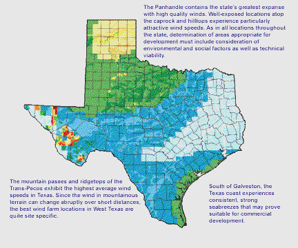
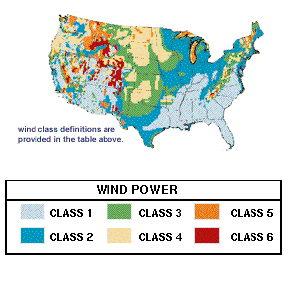
Vast areas with high wind power potential exist in Texas. Figures 6
and 7 on this page show average annual wind power for the United
States and Texas. Wind power is categorized according to Wind Power
Class. Wind class 1 (light blue) denotes very light winds; higher
numbers indicate stronger winds. In the United States, wind farms
are presently built on tracts with winds of class 5 (orange) and
higher. Technology currently being developed should make class 4
(yellow) wind regimes viable. Eventually, even class 3 (green) wind
regimes are expected to be capable of supporting utility-scale
ventures.
The U.S. map was assembled by the Pacific Northwest Laboratory (PNL)
from available measured wind data. In many areas there were no
measured data. To address this shortcoming, PNL scientists
partitioned the country into thousands of uniformly sized pieces and
to each piece assigned a constant value for wind class. This is what
gives the map its jagged, "pixelized" appearence.
The Alternative Energy Institute (AEI) at West Texas A&M University
constructed the improved resolution Texas wind map as a refinement
of the PNL map. It incorporates additional ground exposure
information. A hilltop, for example, will experience stronger winds
than the base of a valley. The AEI used elevation and prevailing
wind data to compute exposure and reclassify wind power throughout
the state.
While helpful, this technique is not a precise tool. Some areas on
the map may, with improved data, turn out to be windier than
indicated, while others may be worse. Overall, the reclassified map
simply identifies promising regions in which to focus future
assessment activities and development; the true potential of a
specific site can only be determined from long-term, quality
measurements.
The Texas map identifies three major areas with good wind power
potential: the Great Plains, the Gulf Coast, and specific ridgetops
and mountain passes throughout the Trans-Pecos. The electric
generation potential of the windy areas of Texas is summarized in
Table 3, below. These values reflect exclusions for various
technical and environmental constraints. The table points out that
Texas contains enough class 4 resource to produce all of the
electricity currently consumed in the state. Even when utilizing
only class 5 and 6 lands, wind power could generate a significant
portion of the state's electricity.
TABLE 3. Potential Electricity Production on Windy Lands in Texas
WIND POWER CLASS
AREA (km2)
PERCENT OF STATE LAND
POTENTIAL CAPACITY (MW)
POTENTIAL PRODUCTION (Billion kWh)
3% OF TEXAS ELECTRIC CONSUMPTION
396,000
Potential Value of Resource in
Texas
Wind is a highly variable resource, but with proper understanding it
can be readily incorporated into an electric utility's generation
mix. This fact has already been recognized by Texas wind developers
and electric utilities active in the state's nascent industry. The
Panhandle, mountainous parts of West Texas, and perhaps even the
lower Gulf Coast, contain areas with winds presently suitable for
electric power generation. The number of commercially attractive
sites will only expand as development costs continue to drop and
wind turbine technology improves.
Texas Wind Power Potential
WIND POWER CLASS WIND CHARACTERISTICS 50 METERS
ABOVE GROUND*
POWER
(W/m2) SPEED
(mph) COMMERCIAL
VIABILITY
EXCELLENT
Fifty meters (164 feet) is a common tower height for large wind
turbines.
this site and its content are not
public domain and are protected by
© COPYRIGHT 2006 - 2013 unauthorized distribution
is a violation of applicable laws
|